 Your new post is loading...

|
Scooped by
DocBiodiv
|
The most comprehensive regulatory database for understanding the legal management of Marine Protected Areas (MPAs). Navigator offers not just a guide to the location of MPAs but also includes the actual regulations for marine protection. Management measures are summarized for layperson use so that fishers and boaters on the water can be aware of rules and regulations where they are located. Additionally, Navigator codes over 20 fishing gears and human activities and states whether these are prohibited, restricted, allowed, or unknown, and lists focal species where identified.
|
|
Scooped by
DocBiodiv
|
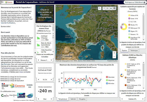
A l'initiative de la Direction Générale des Affaires Maritimes, de la Pêche et de l'Aquaculture afin de donner de la visibilité aux aquaculteurs et de créer les conditions pour le développement durable de leur activité.
|
|
Scooped by
DocBiodiv
|
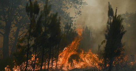
Plus de 785 000 hectares sont partis en fumée en 2022, le double de 2021. Ces feux de forêt ont généré les émissions de 9 mégatonnes de CO2.
|
|
Scooped by
DocBiodiv
|
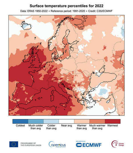
The Copernicus Climate Change Service (C3S), implemented by the European Centre for Medium-Range Weather Forecasts on behalf of the European Commission with funding from the EU, routinely publishes monthly climate bulletins reporting on the changes observed in global surface air temperature, sea ice cover and hydrological variables.
|
|
Scooped by
DocBiodiv
|
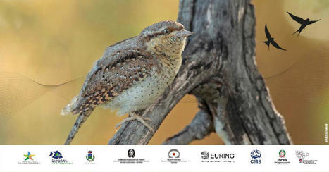
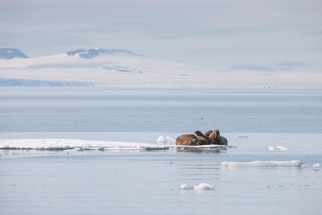
Visualizing how migratory animals connect continents, countries, sites and habitats is the result of an international scientific effort under the aegis of the CMS, in developing the first atlas of bird migration across three continents. CMS, an environmental UN treaty, will launch the Eurasian-African Bird Migration Atlas today at the Museum of Migration on the Italian island of Ventotene, as the first part of a broader initiative to develop a global atlas of animal migration.
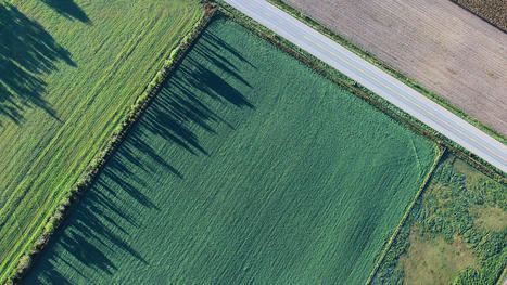
Des informations inédites, précises et faciles d’accès : Nimbo constitue une avancée majeure pour aider l'agriculture à relever le défi environnemental. "La nouvelle carte publiée sur agri.nimbo.earth constitue l’unique source de données disponible sur les superficies occupées par les cultures en 2020 en France métropolitaine et dans dix autres pays européens."
Via AgroParisTech Documentation Hélène Salvat
|
|
Scooped by
DocBiodiv
|
|
|
Scooped by
DocBiodiv
|
Le projet FAUNAPYR est un projet européen (POCTEFA) qui contribue à la protection des écosystèmes transfrontaliers à travers l’amélioration des connaissances de la répartition des espèces de la faune pyrénéenne.
L’objectif de ce projet est de mutualiser, sur un portail unique, l’ensemble des données de faune pyrénéenne.
|
|
Scooped by
DocBiodiv
|
|
|
Scooped by
DocBiodiv
|
On March 7th 2019, 15:00 CET, a dedicated webinar to the project CEETO – Central Europe Eco-Tourism: tools for nature protection was presented by EUROPARC Federation and broadcasted through online channels. This webinar was part of the CEETO project agenda, and it was attended by 206 attendees from more than 15 countries from all over the world.
|
|
Scooped by
DocBiodiv
|
The EU Biodiversity Strategy to 2020 calls on Member States to carry out a mapping and assessment of ecosystems and their services (MAES, Maes et al., 2013). As such, an EU-wide ecosystem assessment was launched to provide harmonised information on the condition of ecosystems and biodiversity, and their capacity to provide ecosystem services. The assessment will provide data for the final evaluation of the EU biodiversity strategy in 2020. This briefing presents recent progress in mapping broad ecosystem types and their associated habitats at European level.
|
|
Scooped by
DocBiodiv
|
Researchers from the Geography Department of Humboldt-Universität zu Berlin (HU) led the creation of the first map of Europe’s last wild forests, including more than 1.4 million hectares in 34 European countries. „It is not that these forests were never touched by man, this would be hard to believe in Europe”, explains Dr. Francesco Maria Sabatini, lead author of the study.
|
|
Scooped by
DocBiodiv
|
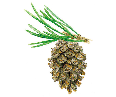
Scots pine (Pinus sylvestris) is a long-living, coniferous tree characterized by its orange trunk. Globally, it is the most widely distributed pine and is found throughout all of Eurasia. The genetic variety is immense and several different subspecies exist across its distribution.
|
|
|
Scooped by
DocBiodiv
|
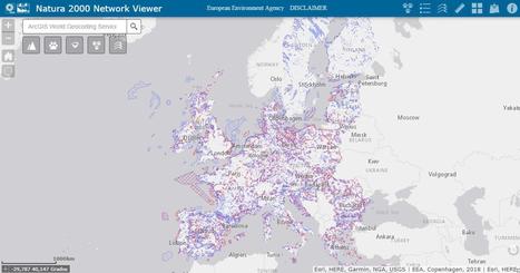
Une nouvelle mise à jour des données (FSD) et de la cartographie des sites Natura 2000 est en ligne sur l’INPN, suite à l’envoi officiel à la Commission européenne de décembre 2022.
|
|
Scooped by
DocBiodiv
|
The Copernicus Climate Change Service (C3S), implemented by the European Centre for Medium-Range Weather Forecasts (ECMWF) on behalf of the European Commission, releases its 2022 Global Climate...
|
|
Scooped by
DocBiodiv
|
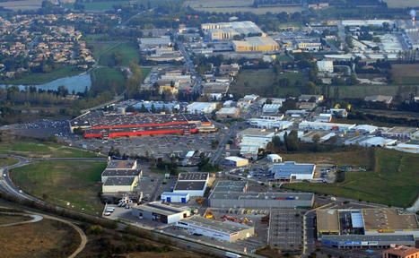
«Les ''entrées'' de la quasi-totalité des villes françaises se ressemblent: elles sont moches et consomment beaucoup d'espace» FIGAROVOX/ENTRETIEN - Pour enrayer le bétonnage du pays, la loi fixe un objectif radical de «zéro artificialisation nette» des sols d'ici 2050. Si l'objectif est louable, est-ce possible ? Et peut-on appliquer cette règle partout ? Le géographe Laurent Chalard explique où en est la France.
|
|
Scooped by
DocBiodiv
|
«C ’est pire que prévu », s’alarme le Système européen d’information sur les feux de forêt (EFFIS). Depuis le début de l’année 2022, soit depuis moins de huit mois, 517 881 hectares — plus de 5 000 kilomètres carrés — ont déjà été ravagés par les flammes en Europe — l’équivalent du département de la Mayenne. C’est déjà davantage que les 470 359 hectares (4 700 kilomètres carrés) brûlés pendant l’ensemble de l’année 2021. Si la tendance se poursuit, 2022 pourrait ainsi égaler ou dépasser 2017, année la plus catastrophique (...)
|
|
Scooped by
DocBiodiv
|
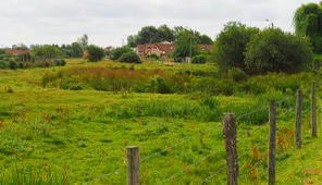
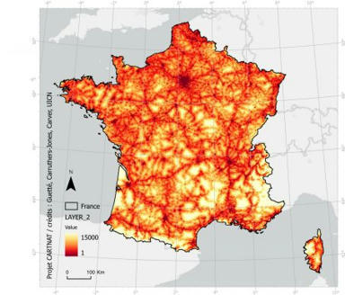
Des géographes ont réalisé la carte de France des espaces naturels les moins touchés par l’activité humaine, et ce sans quitter leur bureau, grâce aux bases de données existantes.
|
|
Scooped by
DocBiodiv
|
We assessed the relative species richness of vascular plant families within forests, grasslands, scrub and wetlands across Europe based on the European Vegetation Archive data.
|
|
Scooped by
DocBiodiv
|
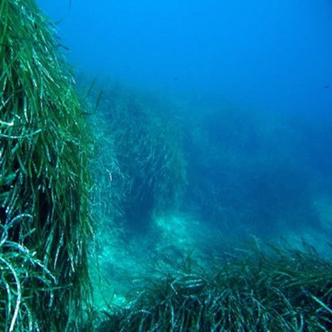
The ocean plays a key part in the regulation of our planet’s climate. Ocean currents redistribute heat from the equator to the poles and as the water sinks to the deep ocean, it stores much of the excess CO2 and associated heat released by the burning of fossil fuels[1]. However, this climate regulation comes at a cost. As the deep ocean warms and becomes more acidic (due to the increase in dissolved CO2), the amount of available oxygen and food particles at the seafloor is projected to decrease as well[2]. It is predicted that this could have devastating effects on life in the deep sea, including many deep-water coral species and commercially important fish species[3].
|
|
Scooped by
DocBiodiv
|
DOPA Explorer, which was first launched in April 2015 as part of the JRC's Digital Observatory for Protected Areas (DOPA), assesses the state of and the pressure on terrestrial, marine and coastal protected areas. It identifies those protected areas with important ecosystems and species, and assesses the pressures they are exposed to because of human activities.
|
|
Scooped by
DocBiodiv
|
Data from the marine environment are a valuable asset. Rapid access to reliable and accurate information is vital in addressing threats to the marine environment, in the development of policies and legislation to protect vulnerable areas of our coasts and oceans, in understanding trends and in forecasting future changes. Likewise, better quality and more easily accessible marine data is a prerequisite for further sustainable economic development, so-called ‘blue growth’.
|
|
Scooped by
DocBiodiv
|
Le Pôle Thématique Surfaces Continentales Theia est une structure nationale inter-organismes ayant pour vocation de faciliter l’usage des images issues de l’observation des surfaces continentales depuis l’espace.
|
|
Rescooped by
DocBiodiv
from EntomoNews
|
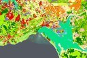
Les chercheurs de l'UE ont détecté de multiples résidus de pesticides dans les sols agricoles européens, ce qui souligne la nécessité d'une meilleure surveillance. Publié le 04.02.2019 Pesticide residues in European agricultural soils – A hidden reality unfolded - Science of the Total Environment, 06.11.2018 https://www.sciencedirect.com/science/article/pii/S0048969718343420#f0035 [Image] Distribution of total pesticide contents in EU agricultural topsoils (0–15/20 cm) at the NUTS 2 level.
Via Bernadette Cassel
|
|
Scooped by
DocBiodiv
|
Primary forests have high conservation value but are rare in Europe due to historic land use. Yet many primary forest patches remain unmapped, and it is unclear to what extent they are effectively protected. Our aim was to (1) compile the most comprehensive European‐scale map of currently known primary forests, (2) analyse the spatial determinants characterizing their location and (3) locate areas where so far unmapped primary forests likely occur.
|


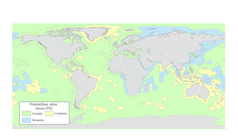


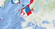


via @MPAsSA1 Explore in-place marine protections for over 110 countries and territories. Poster Europe