


 Your new post is loading...

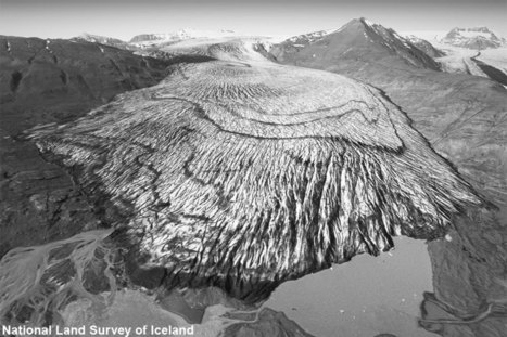

A photography project has highlighted the extent of ice loss from Iceland’s largest glaciers. A team from Scotland and Iceland compared photographs taken in the 1980s with present-day drone images. They focused on the south side of the Vatnajökull ice cap, which covers about 7,700sq km of land.
Dr Kieran Baxter, from the University of Dundee, said: "We saw a staggering difference in a very short amount of time."


Voir aussi cet article pour comprendre la méthodo de l'étude et les enjeux technologiques, drones etc : "How to Combine Old Aerial Photos and Modern-day Drone Photography" 02/11/2019 https://www.hydro-international.com/content/news/how-to-combine-old-aerial-photos-and-modern-day-drone-photography
et le compte Twitter @AliceWatterson participant à l'étude.