 Your new post is loading...
Le Global Safety Net combine six différents indicateurs de données primaires : les zones protégées déjà existantes, les habitats abritant des espèces rares, les zones riches en biodiversité, les sites habités par de grands mammifères, les vastes régions sauvages encore intactes et les environnements naturels capables d’absorber et de stocker une large quantité de carbone. […]
Via Hubert MESSMER , Les Sentinelles du climat

|
Scooped by
DocBiodiv
|
Protected Planet by the UN Environment Programme World Conservation Monitoring Centre (UNEP-WCMC) is a staggering achievement of data management that catalogues our planet’s most precious places. The open data platform visualizes and shares detailed geographic data on 250,000 conservation areas around the world, available for anyone to use.
|
|
Scooped by
DocBiodiv
|
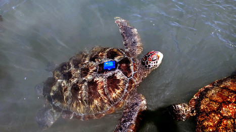
Pour favoriser des mesures de conservation efficaces de deux espèces de tortues marines en danger d'extinction, l’Ifremer a développé une nouvelle génération de balises pour suivre les jeunes individus et mieux connaître l’utilisation de leurs habitats.
|
|
Scooped by
DocBiodiv
|
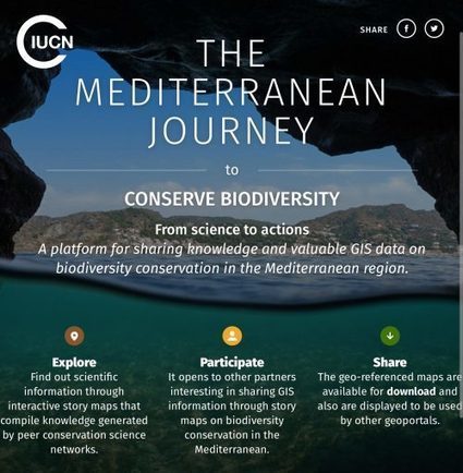
Une plateforme interactive pour le partage de données sur la conservation de la biodiversité en Méditerranée Grâce au soutien de la Fondation MAVA, le Centre de Coopération pour la Méditerranée de l’UICN (UICN-Med) a lancé une plateforme collaborative pour partager les connaissances et les données du système d’information géographique (SIG) qui permet de raconter des histoires en utilisant des documents consensuels, pour présenter des données interactives sur la conservation et la biodiversité. La nouvelle plateforme « MED CONSERVATION MAPS » vise à accumuler les connaissances générées par les réseaux scientifiques de conservation, toujours sur la base d’une histoire.
|
|
Scooped by
DocBiodiv
|
The workshop will focus on three main subject areas: - the roles of satellite images in conservation monitoring;
- the roles of drone images in conservation monitoring; and
- open source software packages that can increase the efficiency, accuracy and precision of our work;
- the role of citizen science.
|
|
Scooped by
DocBiodiv
|
Attitudes among conservation biologists towards technological innovations and solutions have changed over the years from mistrusting and dismissive to widely accepting. However, the time has come for the conservation community to move from being technology consumers to become innovation leaders and to actively seek to create novel technologies to provide conservation tools and solutions.
|
|
Scooped by
DocBiodiv
|
L’État a prévu la mise en place d’un système d’Information de la biodiversité, afin d’appuyer les politiques publiques de connaissance et de conservation de la biodiversité.
Ce système d’information a notamment vocation à renforcer et étendre les dispositifs existants, dont le système d'Information sur la nature et les paysages, l’inventaire du patrimoine naturel et les observatoires de la biodiversité.
|
|
Scooped by
DocBiodiv
|
The distributions of amphibians, birds and mammals have underpinned global and local conservation priorities, and have been fundamental to our understanding of the determinants of global biodiversity. In contrast, the global distributions of reptiles, representing a third of terrestrial vertebrate diversity, have been unavailable. This prevented the incorporation of reptiles into conservation planning and biased our understanding of the underlying processes governing global vertebrate biodiversity. Here, we present and analyse the global distribution of 10,064 reptile species (99% of extant terrestrial species).
|
|
Scooped by
DocBiodiv
|
Seagrass Spotter is a conservation and education tool for tracking seagrass meadows around the globe. Help us conserve our coastline by uploading your own seagrass sightings.
|
|
Scooped by
DocBiodiv
|
L’application Cyn’Actions Biodiv’, sous forme de carte interactive, vous donne accès aux actions entreprises en faveur de la biodiversité par les fédérations de chasseurs sur l’ensemble du territoire. Chaque espèce faunistique, floristique et milieu naturel fait l’objet d’une description et d’une cartographie dynamique. Elle est mise à jour en continu
|
|
|
Scooped by
DocBiodiv
|
Many conservation managers, policy makers, businesses and local communities cannot access the biodiversity data they need for informed decision-making on natural resource management. A handful of databases are used to monitor indicators against global biodiversity goals but there is no openly available consolidated list of global data sets to help managers, especially those in high-biodiversity countries. We therefore conducted an inventory of global databases of potential use in monitoring biodiversity states, pressures and conservation responses at multiple levels. We uncovered 145 global data sources, as well as a selection of global data reports, links to which we will make available on an open-access website. We describe trends in data availability and actions needed to improve data sharing. If the conservation and science community made a greater effort to publicise data sources, and make the data openly and freely available for the people who most need it, we might be able to mainstream biodiversity data into decision-making and help stop biodiversity loss.
|
|
Scooped by
DocBiodiv
|
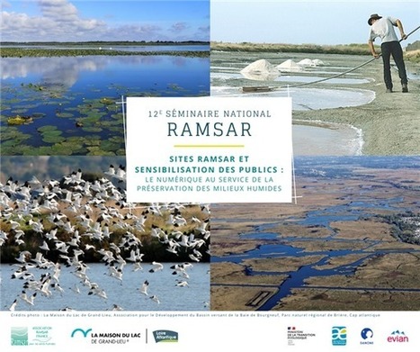
Deux journées en visio-conférences. Ces adaptations nécessaires de nos pratiques nous permettent d’éprouver très concrètement le rôle primordial du numérique dans notre collaboration et nos actions. Et les prises de conscience écologiques qui accompagnent la crise sanitaire ne font qu’affirmer davantage l’importance de la mission des sites Ramsar : la conservation et l’utilisation durable des zones humides à travers le monde.
|
|
Scooped by
DocBiodiv
|
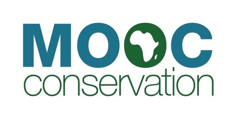
Tous les cours actuellement disponibles : - MOOC Gestion des aires protégées
- MOOC Suivi écologique
- MOOC Application des lois
- MOOC Conservation des espèces
- MOOC Valorisation des ressources
- MOOC Nouvelles technologies
- MOOC Développement durable
|
|
Scooped by
DocBiodiv
|
Remote Sensing in Ecology and Conservation is a fully open access journal from Wiley and the Zoological Society of London. The journal provides a forum for the rapid publication of peer-reviewed, multidisciplinary research from the interface between remote sensing science and ecology and conservation. The journal defines remote sensing in its broadest sense, including data acquisition by hand-held and fixed ground-based sensors, such as camera traps and acoustic recorders, and sensors on airplanes and satellites.
|
|
Scooped by
DocBiodiv
|
Understanding the processes related to wildlife recoveries is not only essential in solving human - wildlife conflicts, but also for identifying priority conservation areas and in turn, for effective conservation planning. We used data from a large citizen science program to study the spatial processes related to the demographic and genetic recovery of brown bears in Greece and to identify new areas for their conservation. This was achieved by visually comparing our data with an estimation of the past distribution of brown bears in Greece and by using a Point Process Model to model habitat suitability, and then comparing our results with the current distribution of brown bear records and with that of protected areas.
|
|
Scooped by
DocBiodiv
|
Background Wetlands are highly productive systems that supply a host of ecosystem services and benefits. Nonetheless, wetlands have been drained and filled to provide sites for building houses and roads and for establishing farmland, with an estimated worldwide loss of 64–71% of wetland systems since 1900. In Europe, the Natura 2000 network is the cornerstone of current conservation strategies. Every six years, Member States must report on implementation of the European Habitats Directive. The present study aims to illustrate how Earth observation (EO) technologies can contribute to the reporting obligations of the Habitats Directive and Natura 2000 network in relation to wetland ecosystems.
|
|
Scooped by
DocBiodiv
|
eConservation is a new application that provides critical information in an interactive mapping interface on biodiversity conservation projects funded by big public donors worldwide. The aim is to better understand who is funding what and where, with a view to improve decision-making on biodiversity conservation. Projects can be searched based on many criteria including their location, objectives, timeframe, budget, and the organizations involved. eConservation also provides summary statistics at the level of donors, countries, ecoregions and protected areas.
|
|
Scooped by
DocBiodiv
|
Véritable outil de sensibilisation et de connaissance de la biodiversité française, « INPN Espèces » permet d'explorer de manière simple et ludique la biodiversité qui nous entoure. « INPN Espèces » est la seule application en France permettant de découvrir l'ensemble des espèces de la faune et de la flore françaises (métropole et outre-mer) à travers leurs caractéristiques, leur répartition ou encore leur statut de conservation. Grâce à une entrée facilitée par l'image et à une géolocalisation depuis son mobile, chacun peut ainsi en un clic mieux connaître la nature autour de soi.
Au cours de la dernière décennie, les modèles d’habitat potentiels (Habitat Suitability Models, HSMs), ou modèles de distribution d’espèces (Species Distribution Models, SDMs), ont reçu une attention considérable dans les études de conservation et ont généré un large éventail d’applications. Ces modèles ont été utilisés à la fois pour identifier les variables environnementales qui influencent la distribution des espèces et aussi pour prédire leurs distributions en fonction de différentes variables. Ces modèles ont été utilisés jusqu’à présent principalement pour prédire des distributions à large échelle. Ils peuvent cependant être également utilisés à des échelles spatiales plus fines pour répondre à des objectifs de conservation.
Via Hubert MESSMER
|


![The contribution of Earth observation technologies to the reporting obligations of the Habitats Directive and Natura 2000 network in a protected wetland [PeerJ] | Biodiversité | Scoop.it](https://img.scoop.it/YUJoIt2vhTIkDyhhUxWP0jl72eJkfbmt4t8yenImKBVvK0kTmF0xjctABnaLJIm9)


https://www.globalsafetynet.app/ l'article de Sciences Advances https://advances.sciencemag.org/content/6/36/eabb2824
Par Mongabay. Publié le 07/12 sur le site Echos Planète. Un article qui redonne les liens vers :
le rapport du Giec https://www.ipcc.ch/sr15/,